

Peak District Looksee AR app for iPhone and iPad
Developer: Objexs Limited
First release : 05 Apr 2018
App size: 25.04 Mb
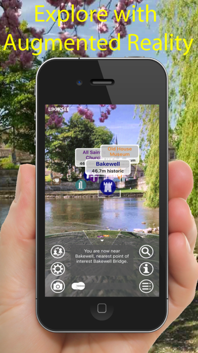
Looksee AR for the Peak District, England, is an Augmented Reality (AR) viewer used to find places of interest directly on your phone cameras screen and add fun, knowledge and interest to your adventures and tours.
Ideal for both tourists and locals wishing to explore and find out more about their surroundings and beyond: whether by foot, bicycle,car, taxi or Uber!
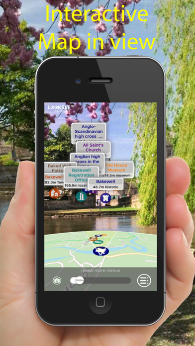
Its simple to use - you just point and go! It includes a choice of Map or Satellite Image in view and a Search function to help locate things.
Once downloaded no wi-fi or cellular network is necessary, so you can use when out and about in the Peak District, even when there is no or poor signal coverage.
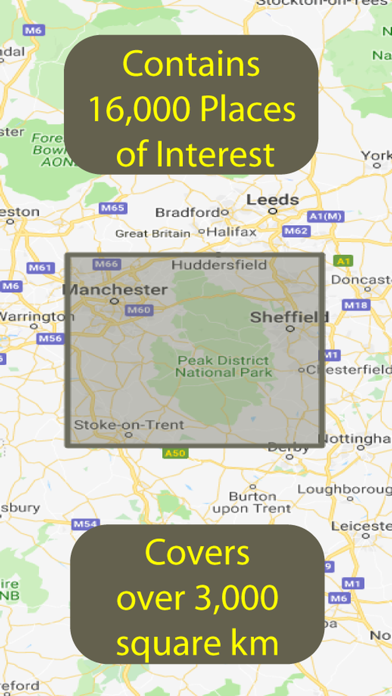
This version, for the Peak District in northern England, locates places in and around the National Park and the wider area, and includes around 16,000 Places of Interest.
The Peak District is characterized by steep limestone valleys like Dovedale, with its famed stepping stones, and Lathkill Dale in the park’s southern area, which is known as White Peak. North, the Dark Peak area has dramatic gritstone ridges and stark moorland plateaus like Kinder Scout, the park’s highest point. The nearby village of Edale marks one end of the iconic Pennine Way footpath.
It reaches a rectangle stretching from and including Manchester in the West to Sheffield in the East, an area of over 3,000 km2.
Categories that can be viewed and selected include Tourist Attractions, Hills, Lakes, Parks & Woodlands, Cities, Towns, Suburban Areas, Villages & Hamlets, Cafes, Restaurants, Cafes, Airports, Train & Major Bus Stations, Municipal Buildings, Places of Worship, Historic Sites and Museums & Arts.
Some of the helpful Looksee features include:
- Interactive objects (that you can touch for more information on them)
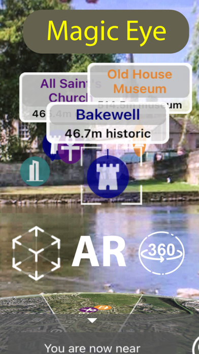
- Magic EYE (to declutter the visuals and select only objects within)
- Satellite or Map image in view (can select which or disable completely)
- Search menu (with on-screen directional arrow and indicator graphics)
- Filters menu (using which the categories of points of interest you wish to display can be easily filtered out or selected)
- Distance slider (for an interactive depth of view filter up to 10km)
- Zoom (using an on screen pinch to zoom gesture)
- Snap-shot camera (for annotating your photos)
- Video recorder for saving and sharing interesting places on social media (accessed by holding the camera icon for 1 second)
- Radar view of everything around you on map (hold face down)
So please enjoy adding interest to your Peak District outdoor adventures!